Growing up in the San Francisco Bay Area, I woke up many nights throughout the years to the sound of books rattling on the shelf, and an odd sensation that felt like floating. The whole world shook side to side subtly, and taking me with it, I couldn't tell whether I was hallucinating or really feeling an earthquake.
In the mornings at school, we would all ask each other, "did you feel it?", which always got divided answers. But the answers were all around us, in our urban environment: small cracks that grew in a straight line in the pavement, growing larger and deeper over the months. These were a reminder of the constant tension between the shifting of the tectonic plates and the manmade structures integrated into their surface.

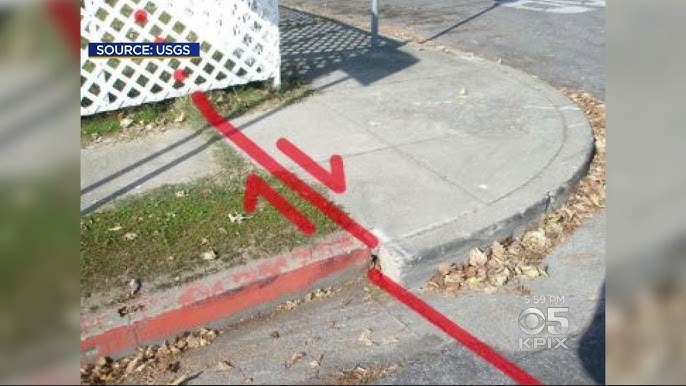
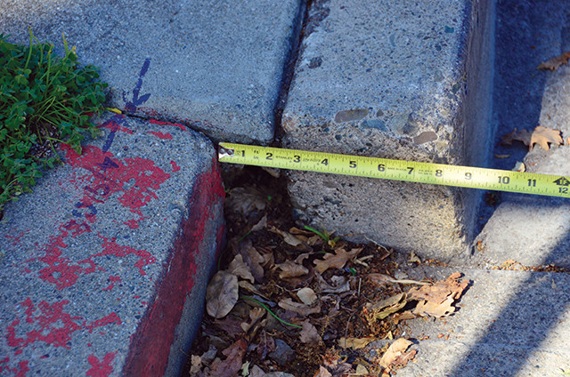
Continuous fault creep is the sign of a greater danger coming, along with the small releases of seismic energy we experienced (small earthquakes). Someday, there will be a strong earthquake -- this is something I have heard (a lot from my mom) throughout my childhood, and it creates a sense of paranoia, since earthquakes are so hard to predict.
The active earthquake faults at play here are the San Andreas Fault Line and the Hayward Fault Line. The Pacific Plate is moving north-northwest relative to the North American Plate at about 5-10 cm per year, and this horizontal transform movement of the plates builds up a lot of friction and stress that is periodically released -- leading to the earthquakes we felt.
Interestingly, the boundary zone between the Pacific and North American plates is not comprised of a single sharp line, but is split among multiple parallel fault lines in the Bay Area -- this shearing tectonic movement is distributed among them.
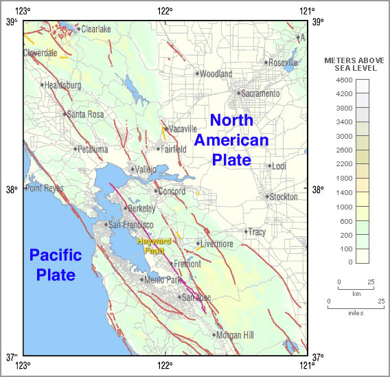
One of these lines, the Hayward Fault, runs through some of the most densely populated cities in the Bay Area, and is intersected by rail lines and freeways. When an earthquake comes, it will wreak total havoc on the manmade systems we have built.
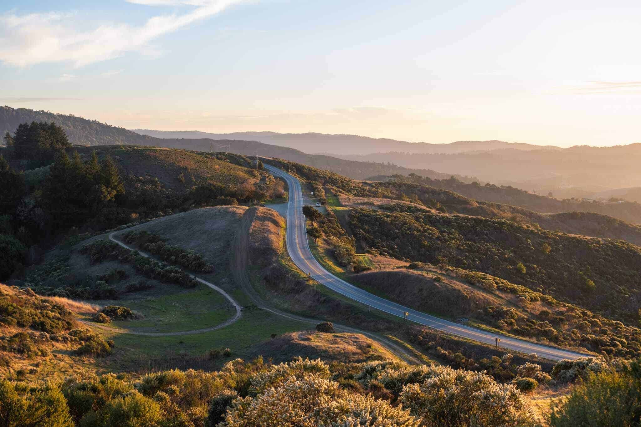
Yet, this tectonic activity has also manifested itself not just as cracks in the pavement, but as strikingly beautiful parallel peaks and valleys in the Bay Area. Topographical features of the Bay Area closely follow the northwest direction of the North American and Pacific plate boundary. This natural phenomenon has created beautiful recreational opportunities and an unusual varied landscape to appreciate.
There are many manifestations of the tectonic movement between these plates, most of which threaten essential infrastructure -- yet there is a positive side to this as well, in the unique landscape created on this boundary. Major highways in the Bay Area all parallel each other due to the thoughtful planning of road builders who capitalized on the convenience of the valleys formed by the main faults. The concern here is not if, but when the large populations of urban areas will have to face the next big slip earthquake, predicted by USGS (United States Geological Survey) before 2043 to be a magnitude of at least 6.7.
References
Berkeley, UC. “When Creep Becomes Unsteady.” Berkeley.edu, 2018, seismo.berkeley.edu/blog/2018/06/19/when-creep-becomes-unsteady.html.
“Faultline: Earthquake Faults & the San Andreas Fault | Exploratorium.” Annex.exploratorium.edu, annex.exploratorium.edu/fault-line/basics/faults.html.
Rademacher, Horst. “Walking the Line -.” Bay Nature, 20 July 2012, baynature.org/article/walking-the-line/. Accessed 1 Oct. 2025.
Comments
Post a Comment