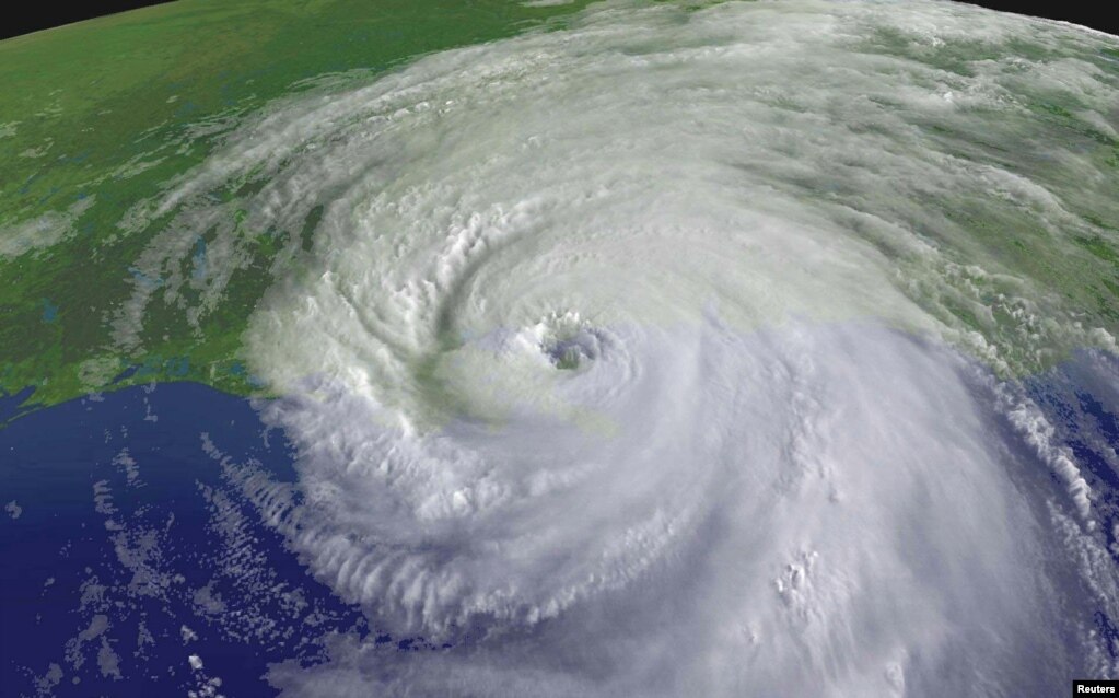
On August 23rd of 2005, a tropical depression
formed over the Bahamas, developing into a tropical storm by the 24th
as it moved West, crossing over Southeast Florida and into the Gulf of Mexico,
where it greatly increased int intensity. On the morning of August 29th,
2005, Hurricane Katrina made landfall on Plaquemines Parish, Louisiana as a
Category-4 hurricane.
A mandatory evacuation had been ordered by the mayor the day
before landfall. State police reversed the lanes on three different
Interstates, allowing about 1 million people to evacuate the greater New
Orleans area faster. But despite these efforts, about 150,000 people remained
in the city, and were not evacuated until September 2nd.

Those that did not evacuate in time used the Superdome as a
shelter (slate.com).
Although areas of the city received as much as 15 inches of
rain from August 28th-30th, the main source of the
flooding was storm surge, which was not helped by the canals built throughout
the city. Surge was estimated to have reached heights of 18 feet along the
coast of St. Bernard Parish, and 26 feet along a portion of the Mississippi
coast and Bay St. Louis
Almost a month later, Rita struck the Southwestern side of
Louisiana (along with Eastern Texas) as a Category-3 Hurricane with a storm
surge of up to 16 feet, causing an additional $4.7 billion in damage.
The national government(specifically FEMA) was not
particularly quick to respond and did not do a great job of handling the
aftermath of the disaster. FEMA denied, blocked, or turned away help from
volunteering medical professionals, Amtrak’s offers to help evacuate victims,
trucks full of water from Walmart, diesel fuel from the Coast Guard, and
emergency supplies from The Red Cross and numerous other efforts to help the
city.

Sources:
Kent, Joshua D. “2005 Louisiana Hurricane Impact Atlas:
Volume 1” Louisiana Geographic Information Center, 2005.
Ross, Janell. “The Art -and Controversy- of Hurricane
Katrina ‘X-Codes’.” The Washington Post, 2015.
<https://www.washingtonpost.com/news/the-fix/wp/2015/08/29/the-hurricane-katrina-x-codes-art-politics-controversy-and-now-reform/?noredirect=on&utm_term=.26ea1507de1b>
<https://www.washingtonpost.com/news/the-fix/wp/2015/08/29/the-hurricane-katrina-x-codes-art-politics-controversy-and-now-reform/?noredirect=on&utm_term=.26ea1507de1b>
“Extremely Powerful Hurricane Katrina Leaves a Historic Mark
on the Northern Gulf Coast.” National Weather Service, 2016. <https://www.weather.gov/mob/katrina>
Edwards, Chris. “Hurricane Katrina : Remembering the
Federal Failures.” Cato Institute, 2015. <https://www.cato.org/blog/hurricane-katrina-remembering-federal-failures>
It is sad to see the last picture...I wonder why didn't the weather station forecast the later category-3 hurricane? Is that because they lose their alertness when busy dealing with Katrina? I think the government should improve the education of natural disaster like hurricane and flood which have higher occurrence likelihood to citizens, in this way they may have the will to evacuate next time when there'a a hurricane alert next time.
ReplyDelete